Sporadic Rainfall Brings Relief To Parts Of Texas

Recent rainfall helped relieve some areas across Texas, but more is needed to escape drought conditions, according to Texas A&M AgriLife Extension Service experts.
After receiving above-average rainfall in May and June, the state was hit with extremely hot and dry conditions throughout July and August.
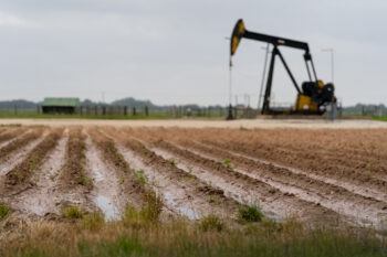
Over the past week, the Panhandle, South Plains and parts of Central and East Texas received 2 or more inches of rain to help with crop production and planting for the next season.
AgriLife Extension agronomist Dr. Jourdan Bell said the rainfall will help the soil moisture profile, but the timing also could negatively impact farming schedules.

“When looking at these areas, we have to consider the intensity of rainfall we experienced this week,” she said. “Will the recent September rain negatively impact the harvest? Or will it assist the end of our summer crops?”
Rainfall In The High Plains
Across the High Plains, rainfall was extremely variable. Sporadic showers delivered anywhere from 4/10 of an inch up to 4 inches of rainfall.
“The rain we’ve received could have benefited our crops,” Bell said. “But when we received rain in some areas, cotton farmers were struck with baseball-sized hail in a production period that is extremely detrimental.”
Other areas of the High Plains that produce corn, sorghum and forages are in reproductive stages when moisture is critical. Those producers should benefit from the rainfall and move into wheat planting season with adequate soil moisture to plant the cool-season crop.
Areas that received no rainfall and were relying heavily on irrigation systems were expected to see lower yields this year due to a lack of well capacity to help fields overcome the drought.
“Generally, when we haven’t received normal precipitation, irrigation systems helped stabilize our crops,” Bell said. “But groundwater has met a point in the High Plains where wells cannot produce enough to help stabilize this production.”
What To Expect
As of Sept. 14, the El Niño is anticipated for a higher chance of rainfall from January to March, said Dr. John Nielsen-Gammon, State Climatologist and Regents Professor of Atmospheric Sciences at the Texas A&M University College of Arts and Sciences.
“We have gotten more rain the past week than we have in the last month,” Nielsen-Gammon said. “The El Niño is looking more and more prominent. But it’s going to take a lot more rain to break the drought since certain areas are 12-15 inches below normal water level.”
As far as temperatures go, the rain received across the state will keep those areas below triple-digit temperatures. The South and southwestern parts of the state like Laredo and Big Bend areas will continue to reach triple-digit numbers, Nielsen-Gammon said.
This article by Randi Williams originally appeared on AgriLife Today.


