Leveraging Big Data And AI For Disaster Resilience And Recovery

In a world where natural hazards can strike at any time with devastating consequences, reducing their impacts in advance may seem impossible.
The unpredictability of these events and their effects makes it challenging to anticipate and respond appropriately, leaving individuals and communities vulnerable to their destructive effects.
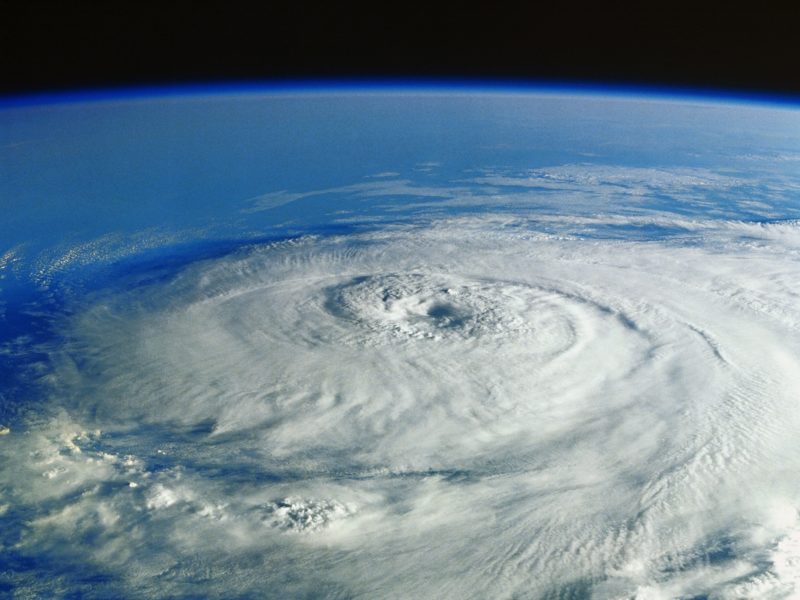
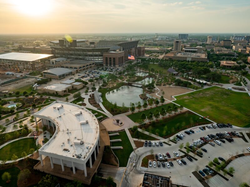
In 2017, Hurricane Harvey made landfall along the Texas coast as a category four hurricane and slowed to nearly 5 mph as it moved inland. Palacios experienced a storm surge exceeding 8 feet. The storm dumped 56 inches of rain in the Friendswood area and more than 60 inches near Nederland and Groves. The National Hurricane Center reported $125 million in damage because of Hurricane Harvey.
Now, researchers from the Zachry Department of Civil and Environmental Engineering at Texas A&M University have created models using big data and artificial intelligence (AI) to help communities prepare for future natural disasters, assess the impacts and monitor the recovery in near real time. They used data from Harvey to test these AI-centric solutions.
Led by Dr. Ali Mostafavi, Zachry Career Development Associate Professor, the Urban Resilience.AI Lab is leveraging AI and big data for predictive risk analysis, predictive infrastructure failure assessment, situational awareness during the event, monitoring of recovery and rapid assessment of the impacts of disasters.
“When facing hazards, there are certain capabilities that AI and data science approaches provide or enhance that can improve the resiliency of communities to these disasters,” Mostafavi said. “Our vision over the past four or five years has been to improve disaster resilience by developing different classes of AI-based models that could provide foresights and insights critical for mitigation, preparedness, response and recovery.”
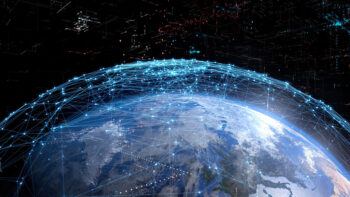
The growth of data from different types of sensors — from physical, social and other sensing technologies — has given researchers tremendous information to work with in creating these models.
“These days, cities and communities are essentially data factories. You can evaluate sensor data related to the condition of the community facing hazards from the traffic network cameras, people’s cell phone activities, power outage data, flood gauge data, satellite images and many other sources of technology that harness the heartbeat of the community,” Mostafavi said. “As our cities and communities become smarter with information and communication technologies, the amount of data generated grows.”
Mostafavi and his team in the Urban Resilience.AI Lab are taking the lead in harnessing community-scale big data to develop AI-based models with the potential to impact communities before, during and after a natural disaster or crisis.
Road Inundation Prediction
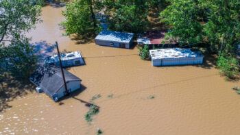
Roads are essential in urban cities, allowing goods, information and people to move from place to place. But during times of disaster, such as floods, road networks can be damaged or blocked, which impacts access to services such as hospitals, shelters and grocery stores. During floods in urban areas, vehicle accidents resulting from driving on flooded roads have been identified as a leading cause of fatalities, highlighting the failures of road networks.
Researchers have developed a deep-learning framework to effectively predict near-future flooding of roads. They tested the framework using three models, and the results showed that it can accurately predict the flooding status of roads with 98% precision and recall values of 96%. Researchers validated the models using the 2017 Hurricane Harvey flooding.
Knowing the flooding status of roads can help affected communities avoid flooded streets and aid emergency management agencies in planning evacuations and delivery of resources.
Situational Awareness Of Hurricane Preparedness
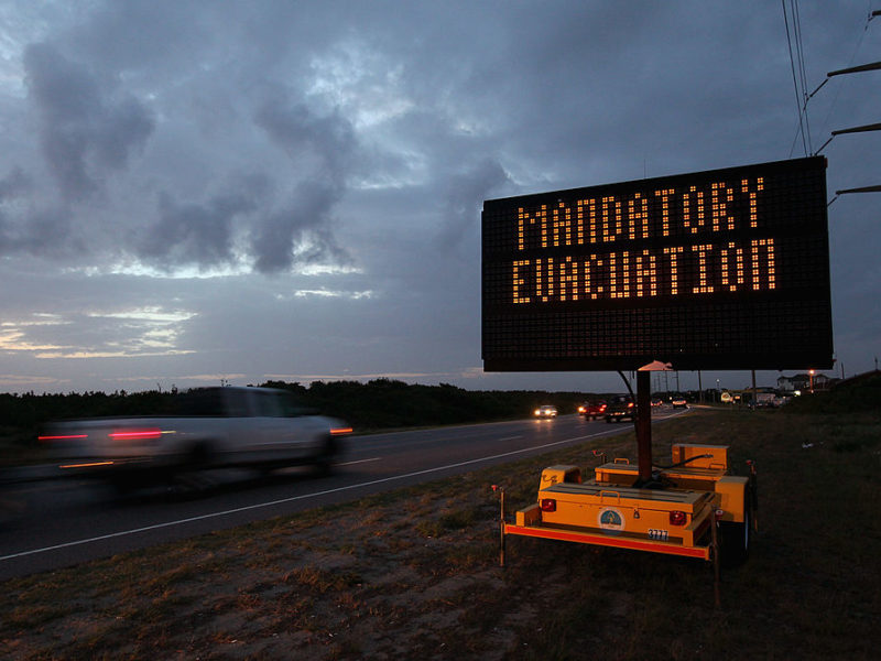
The National Oceanic and Atmospheric Administration reports from 1980 to 2020, the damage caused by hurricanes in the United States reached $945.9 billion, with 6,593 deaths. Knowing what to do before a hurricane hits is essential to decreasing the adverse effects and disruptions it can bring. This means having enough food, water and other essentials and making necessary home repairs.
Historically, surveys have measured how well households are prepared during hurricane season. Researchers used location-based big data from smartphone devices to proactively monitor hurricane preparation. They looked at three critical dimensions of hurricane preparedness: extent (how widespread is it?), timing (how early do people start preparing?) and spatial distribution (where are the hotspots?).
“We have developed metrics and models that we can proactively monitor community hurricane preparedness. Which areas are preparing earlier? Which areas are preparing more based on how many trips they make to grocery stores, pharmacies and gas stations?” Mostafavi said. “We can identify areas that are underprepared. If an underprepared area hasn’t evacuated, it’s a recipe for disaster.”
Researchers focused on smartphone data on visits to businesses, such as grocery stores and pharmacies, to indicate how prepared the local population was for Hurricane Harvey in 2017. The results labeled regions with a decrease in visits as “underprepared” and those with an increase in visits as “highly prepared.” They saw that low-income households were more likely to prepare for the hurricane than those with higher incomes, likely because they lacked the means to protect themselves in other ways. The study outcomes allow emergency response managers and public officials to identify underprepared areas and better allocate resources promptly.
“If areas are impacted (and unprepared), they won’t have power. They won’t have water. They won’t have food. They won’t have medications,” Mostafavi said. “But by using our models, we can identify the hotspots of various underprepared areas proactively before a hurricane lands.”
Mobility And Access During Disasters
Researchers proposed and tested an adaptive AI model that can learn how people typically move from place to place and adapt when an emergency, like flooding, a wildfire or a hurricane, happens. This model is helpful because there are not a lot of data available about how people travel during an emergency.
“Using reinforcement learning techniques we have developed, we can identify flood impacts on traffic patterns and disrupted access to critical facilities,” Mostafavi said.
To test the model, millions of past travel trajectories were used. The researchers tested the model to see how flooding during Hurricane Harvey impacted traffic and congestion in Houston. Results showed the model could make accurate predictions with a mean percentage error of 4.26% and precision and recall at the learning stage of 76%.
Instead of merely choosing the shortest route, the model leverages the vehicle’s surroundings to anticipate its movement. Researchers say the model can identify which roads are affected by flooding and simulate mobility during different flood scenarios.
Damage Assessment Using Satellite Images
After a natural disaster hits, the damage assessment of homes and buildings can take months.
To address this challenge, researchers (in collaboration with Simon Fraser University) developed a new deep-learning model called DAHiTrA, which uses high-resolution satellite images to classify different levels of destruction after natural disasters. This can be helpful after large-scale events like Hurricane Harvey.
The model recognizes the geographic features in different locations and captures the changes over time. It then compares images of a building taken before and after a disaster to determine the level of damage. It can also be applied to other types of civil infrastructure, such as roads and bridges.
“The satellite images are available within 24 hours, and our models are fast,” Mostafavi said. “So, the day after an event, you can know how many buildings have been damaged, the extent of the damage and how many buildings have major damage.”
One of the fundamental strengths of DAHiTrA is its ability to accurately determine the boundaries of a building, which allows for more precise damage assessment. It also detects multiple types of damage, including collapse, partial damage and water damage.
The model analyzes large volumes of satellite images in a short time, which is essential for rapid response and recovery efforts after a disaster. This allows for faster and more accurate damage assessments, which can help communities and governments allocate resources more effectively.
Mostafavi said the team is actively working with government agencies, emergency management offices and even international organizations to use their model to assess building damage. One recent example is a use-case project with the Texas Department of Emergency Management.
Proactive Recovery Monitoring After Disasters
Researchers also examined how people recover after a disaster, specifically during the short-term period after a hurricane. The study focuses on when people return home after evacuating and how long they can stay in their homes without having to move out again. The study uses location-based data to see how quickly people in different areas can do these things.
The study found that more than half of the census tracts in Harris County returned from evacuation within five days after the landfall of Hurricane Harvey and stopped moving out after six weeks. Some areas take longer than others to recover, and there are differences among different groups of people.
Researchers examined how people of different socio-demographic statuses (like income or rental status) responded to flooding. By looking at how quickly they evacuated or relocated, the team could understand different recovery patterns in various subpopulations. While the study shows it took longer to return in flooded areas than in nonflooded areas, there wasn’t a significant difference between the two areas regarding evacuation and relocation for low-income populations.
The return time of high-income census tracts were longer than those of low-income census tracts when flooded, indicating the inability of low-income populations to evacuate and relocate. The study also found that areas with shorter return durations may not be more resilient to disaster, as they may indicate challenges faced by low-income and minority populations that require additional assistance and resources.
Future Direction
“Our vision is to create a future where data science and AI technologies are leveraged to predict, prepare for and equitably respond to natural hazards, enabling us to mitigate their impact on communities,” Mostafavi said. “Our work so far shows the promising potential of big data and AI for augmenting different capabilities needed for disaster resilience. We are collaborating with various public and private sector organizations to develop, scale and deploy the AI technologies created in the lab.”
This article by Alyson Chapman originally appeared on the College of Engineering website.