Engineering Student 3-D Prints Tactile Maps For The Visually Disabled

Tyler Wooten was a freshman engineering student at Texas A&M University when he came up with an idea that could have a lasting impact on students with visual impairments. Eight months later, his idea — a three-dimensional, tactile map with braille — has come to fruition.
Wooten, who will be a sophomore in mechanical engineering this fall, took a 3-D printing class at the Engineering Innovation Center (EIC) during his freshman year. He began thinking about different ways he could use his newly acquired 3-D printing skills to help others.
Then it came to him — create a three-dimensional map with raised buildings and braille for visually impaired people to use to orient themselves on campus. The idea seemed simple enough, but he needed help to do it right.
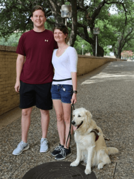
Wooten reached out to Kaitlyn Kellermeyer, a Texas A&M student who had worked on other advocacy projects on campus for the visually impaired.
Kellermeyer, who is blind, was the perfect person to provide insight for Wooten. He emailed her and within two hours they met to discuss the project.
“She said ‘Just go do it,’” Wooten said.
It took a lot of trial and error, but these tactile maps could become available on the Texas A&M campus for students and visitors who are visually impaired.
Tracey Foreman, assistant director of disability services at Texas A&M, said tactile graphics are used to aid people with visual disabilities to better understand graphs, maps and other diagrams. She said most tactile maps are created using braille embossers, Thermoform images or Swell paper.
“Having access to a tactile map allows a visually impaired individual to better understand the scale, size and proximity that cannot always be gathered solely by walking around or having something verbally described to the individual,” Foreman said.
Kellermeyer’s story
Kellermeyer, a senior economics student, became blind in March of 2014 when she was a freshman at Texas A&M. The Double Oak, Texas, native lost sight in her left eye when she was a toddler. Doctors attempted many risky surgeries to prevent her from losing sight in her right eye — the last of which left her completely blind.
“It was very hard at first,” she said. “I lost my sight in the middle of the spring semester.
But Kellermeyer did not drop out of school.
“My friends created this little network of support,” she said. “They’d walk me between classes. They’d read me things. They’d go to class with me and in some cases help me take notes. That was really awesome.”
Even though Kellermeyer had seen campus before, she didn’t realize how difficult it would be to find her way around.
“I had memories of where everything was relationally,” she said. “With all the open space on campus, and with the lack of auditory cues, I didn’t realize how hard it would be to get around.”
Kellermeyer describes that semester as frustrating and upsetting. She felt alone and stuck to a very strict path around campus, never veering off course for fear of getting lost.
When Wooten approached her about the maps, Kellermeyer was delighted. She missed being able to look at a map to get a bird’s-eye view of an area.
“When I lost my sight, I lost the ability to use a map,” she said. “This has been awesome for me to have that ability again.”
Now Kellermeyer has more freedom to explore. She’s even used the map to help her sighted friends find buildings on campus.
Wanting to make a difference
What started as an idea to help others may now be an opportunity for Wooten to become an entrepreneur.
“I had never met a visually impaired or blind person before in my life,” he said. “But I recognized the problems those people could be faced with, and I wanted to make a difference.”
After speaking with Kellermeyer, Wooten went home and downloaded SolidWorks, the software used to design 3-D-printed items. Wooten got to work right away, printing the first of many maps that week.
“She shrieked the first time she held it,” he said of Kellermeyer. “It was awesome to see it transform from an idea to something that could actually help.”
Each map takes roughly 10 hours to complete. Wooten would drive to College Station twice a week over the summer, working long hours in the EIC. His persistence paid off.
Wooten has also designed 3-D-printed tactile maps for Westbrook Intermediate School in League City, Texas, and the Brazos Valley Center for Independent Living in Bryan, Texas. He recently taught his friend how to use SolidWorks and said he’s preparing for an increase in demand. Without really trying, Wooten’s 3-D printed maps have become a small business — one with far-reaching benefits.