Historic Texas Maps On Display At Texas A&M’s Cushing Library
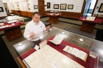
One of the only pristine historical maps of Texas now resides at Texas A&M University’s Cushing Memorial Library and Archives. This map, among others, will be on display through Dec. 9 as part of the exhibit “Charting Texas – A History of the State Through Maps.”
The exhibition, located on the library’s second floor, features several maps and books documenting centuries of exploration and political competition for one specific area of North America – Texas.
“I am excited about ‘Charting Texas’ since the exhibit brings into view so much history and geography of Texas from these beautiful, yet revealing and informative maps,” said Anton duPlessis ’03, curator of the Louise and Floyd Chapman Texas and Borderlands Collection.
Thanks to advancements over time in geographic knowledge, surveying techniques and printing technology, visitors can see the history of Texas’ borders and statehood emerge through the colorful display of a skillfully curated selection of 70 historical maps with accompanying manuscripts and books.
“You’ll see how Texas changes through the purchase of land grants and with the impact of immigration. And then ultimately governmental decision making at the local and federal levels,” said Director of Cushing Library Beth Kilmarx.
Among the collection is Stephen F. Austin’s 1830 Map of Texas, a landmark piece of Texas and cartographic history as the first map of Texas to be printed in the United States by H.S. Tanner and the second map of Texas ever to be printed – the first being printed in Mexico City.
As part of Austin’s land agreement with the Mexican government, Austin had to prepare a map depicting rivers, coasts and characteristics of the land. His map provides a detailed and accurate illustration of Texas derived from his years as an empresario – the person responsible for enticing settlers to the frontier regions of Mexico under Spanish, and later Mexican, rule.
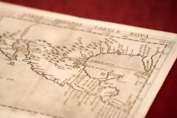
The oldest map in the collection dates to 1574, with the most recent dating to the early half of the 20th century. The shape of Texas evolved, expanded and contracted as wars were won and lost both here and on other continents, Kilmarx said.
The maps in the collection were created to facilitate territorial expansion and assist colonization by claiming lands before they were occupied by colonial powers, heedless of the indigenous population.
“A particular favorite is an early 1760s hand drawn map by a soldier at San Saba showing the locations of Spanish, French, and Indigenous sites across this contested region,” duPlessis said.
Many of the books featured in the exhibit served to promote immigration to Texas, praising the rich, plentiful and inexpensive land and appealing climate. Once settlers arrived in Texas, books and manuscripts provided guides to different property surveying methods with accompanying illustrations and tables that covered the geometric principles of surveying.