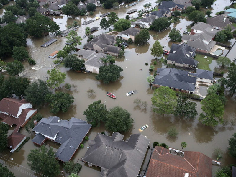
Following Hurricane Harvey, Pollutant Levels In Houston Neighborhood Exceeded Limit For Increased Cancer Risks
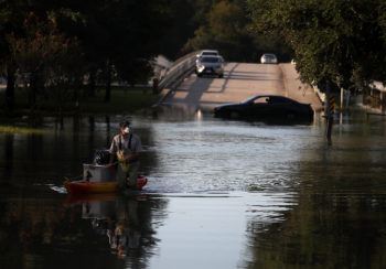
Heavy rainfall and flooding during Hurricane Harvey may have increased risks of exposure to harmful chemicals for people living in environmental justice communities, like the Manchester neighborhood near the Houston Ship Channel.
Soil samples from the neighborhood collected in the week after the hurricane made landfall in 2017 showed high concentrations of pollutants linked with poor health outcomes, including cancer, according to a Texas A&M University study.
Researchers from the Department of Environmental and Occupational Health at the Texas A&M School of Public Health gathered the soil samples from 40 locations throughout the Harrisburg Manchester Super Neighborhood. The area already has high baseline levels of polycyclic aromatic hydrocarbons (PAHs), which result from incomplete burning of hydrocarbons like wood and fossil fuels.
Nearly half of the neighborhood was contaminated, researchers found, and nine of the 40 sites where soil samples were taken exceeded the PAH concentration standard for increased cancer risk. Sites closest to the Houston Ship Channel and highway had the highest concentration of PAHs. Distribution of the pollutants may have been controlled in part by flood waters moving through the area.
The research team was led by Research Assistant Professor Garrett Sansom. Their findings were recently published in the Journal of Health and Pollution.
The Manchester neighborhood is an environmental justice community, which are disproportionately impacted by environmental pollution and inadequately protected from resulting impacts by policies and regulations. The neighborhood is also close to a major interstate highway, a large railyard and several oil refineries.
Previous studies have found the neighborhood has a disproportionately high level of PAH pollution and associated health risks.
PAHs are found in high concentrations near oil refineries, industrial facilities, major highways and transportation hubs like shipyards and railways. PAHs also attach themselves to particles in the area – once they settle, they can be moved around by flood waters.
Researchers note they did not have data on street-level differences in surfaces for their analysis, so it is unclear how much impervious coverage – like streets and sidewalks – contributed to the distribution pattern.
Findings of the study point to the need for a better understanding of how PAHs are dispersed during flood events. More data on baseline pollutant concentrations and improved analysis methods could help researchers, policy makers and community leaders assess and limit the risks faced by people living in environmental justice communities.
This article by Rae Lynn Mitchell originally appeared on Vital Record.