Turning Back The Tide Of Flooding
Flooding is the most disruptive natural hazard in the U.S. It’s also an issue of great significance in Texas, where the Gulf Coast region is home to 7 million people — a population greater than 35 of the U.S. states.
The potential for another Hurricane Harvey-like disaster is ever-present. The hurricane’s catastrophic damage, spread across a 49-county area, ranged in the hundreds of billions of dollars; the damage was exacerbated by decades of development in low- lying coastal areas.
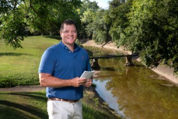
The best response to flooding is a coordinated group of local, regional and national-scale, evidence-based solutions, said Galen Newman, an associate professor in Texas A&M University’s Department of Landscape Architecture and Urban Planning and director of the Center for Housing and Urban Development.
Newman is part of a band of researchers seeking flooding solutions as part of Partnerships for International Research (PIRE), a massive, $3.5 million, five-year initiative funded by the National Science Foundation that includes faculty and student researchers from Texas A&M, Rice University, Jackson State University, and TU Delft in the Netherlands, a nation that has fine-tuned flood mitigation techniques for centuries and is considered the world’s flood prevention leader.
In addition to collaborating year-round with Netherlands flood reduction experts, Newman, with other PIRE-associated faculty, accompanies 15 Texas A&M students to the Netherlands each summer as a part of the PIRE program to conduct flood reduction research with his guidance (the trip was suspended in 2020 due to the COVID-19 pandemic).
Part of the complexity of implementing flood reduction measures is that there’s no “one-size-fits-all” solution, said Newman, who heads the Texas A&M Department of Landscape Architecture and Urban Planning’s PIRE engagement. There’s a variety of measures, such as engineered structures — levees, dikes and seawalls — as well as “green” infrastructure, including wetlands and detention ponds.
There’s also a difference in project size: large scale, such as the previously mentioned dikes; medium scale, such as a park or riparian zone instead of a housing or commercial development in a flood zone, and small scale, such as rain gardens or a bioswale — a landscape element with gently sloped, vegetation-filled sides that removes silt and pollution from storm water runoff and routes it to larger waterways.
“The intent is to also slow the volume of storm water runoff and capture as much as you can to increase its ground absorption,” Newman said. “You’re looking to reduce the amount of impervious surfaces such as parking lots, which are a significant contributor to urban flooding.”
In one study, Newman explored and devised enhancements for integrating the previously proposed Ike Dike – a proposed clay-core dune running along Galveston Island and the Bolivar Peninsula with two large-scale floodgates at opposite ends of the island – into the landscape, with less visual and spatial disturbance. The dike’s proponents see it as a protection mechanism from Galveston Island floods, but the dune, if not integrated correctly, could also become a visual and social barrier that decreases beachfront connectivity and walkability and fragment animal habitat areas.
Newman recommended incorporating elements that would improve the dune by providing economic and social benefits to the area while enhancing the dunes’ flood reduction effectiveness, which could include the placement of:
- Flood ‘overtopping’ detention areas behind the dunes that would attract wildlife and absorb unblocked storm surge;
- Retail spaces, such as cafés and beach equipment rental businesses, between the beach and the dunes;
- Green spaces with bicycle and pedestrian lanes atop and across the dunes, and
- Native plantings to protect the stability of the dunes
In another project, PIRE-affiliated graduate landscape architecture student Zixu Qiao created an award-winning design proposal in 2017 of a medium-density development at a 97-acre site in coastal League City, Texas that is highly vulnerable to flooding and sea level rise.
Her concept’s main feature is a large, central preserved wetland that serves as both a recreational area in dry times and a flood zone during heavy rains or a storm surge. The space’s numerous amenities include a boat launch, a recreational pier and walking paths. A gate protects the development from adjacent Clear Creek floodwaters and a built slope covered with vegetation mimics a natural levee.
Her plan earned a highly coveted 2017 Student Honor Award from the American Society of Landscape Architecture.
Newman’s research also informs his green landscape performance modeling — virtually increasing an existing design’s “green” infrastructure by a predetermined amount, and then seeing how much the flood and storm water associated with the design decreases.
In Houston and in Amsterdam, Newman, with assistance from Youjung Kim, a Texas A&M urban planning faculty member, has modeled future growth based on existing growth patterns to show where new buildings will most likely be developed, and how many of those buildings will be in a future floodplain to help public officials create land-use policies.
For evidence-based research findings to shape policy, however, action is required by policymakers. In Houston, Newman said, policymakers have adopted land-use guidelines for certain kinds of development to reduce flooding, but only a handful of permits following these guidelines have been issued.
A significant step in this direction, he said, would be to greatly increase landowners’ incentives to build on their land with flood reduction measures in mind. “Incentives such as fast-tracking the permit process, waiving building permit fees, tax breaks, and others could be introduced or increased,” Newman said.
This article by Richard Nira originally appeared on the College of Architecture website.