The maiden voyage of the first unmanned aerial system or drone by Texas A&M AgriLife Research in Amarillo was flown over wheat plots just before their harvest in the final week of June.
Dr. Brent Auvermann, Texas A&M AgriLife Research and Extension Center director in Amarillo, said it was the first step into dedicated unmanned aerial system, UAS or drone-based AgriLife Research in the High Plains.
Texas A&M AgriLife already has a well-established UAS program, Auvermann said, but much of the work to date has been done through the Lone Star UAS Center of Excellence and Innovation at Texas A&M University-Corpus Christi or on the Texas A&M University campus in College Station.
“We needed operational freedom to fly under federal rules,” he said. “We couldn’t rely or wait on someone to come from Corpus Christi to fly here. We needed to be nimble. When we get conditions suitable to fly, we need to be ready to go and sometimes we may only have a couple of hours’ notice.”
He said for safety, risk management and compliance, he prefers the winds be 15 mph or less, which doesn’t happen with any consistency in this region.
Auvermann said new regulations published in 2016 by the Federal Aviation Administration made it legal to get individual UAS pilot licenses to operate small crafts weighing less than 55 pounds, under 400 feet above ground level and only in uncontrolled airspace, with a few exceptions.
Seven individuals from AgriLife Research in Amarillo and Lubbock, as well as one U.S. Department of Agriculture-Agricultural Research Service employee at Bushland, went through training and passed a federal exam. That was followed by hands-on training on the Texas A&M University farms near College Station.
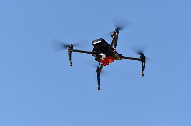
In addition, a four-bladed quadcopter and six-bladed hexacopter have been purchased for use in research programs through the AgriLife center in Amarillo, Auvermann said. The quadcopter is equipped with a digital camera and a RedEdge multispectral camera able to capture visible and infrared light bands. The hexacopter will have a hyperspectral camera able to capture visible, infrared and ultraviolet bands of light.
He said there’s a classic distinction on what is done on the College Station campus and what will be done at the Amarillo research center.
“We want to focus on what the producer can do with the information we are gaining,” he said. “On campus, they are looking at things more on the fundamental and developmental levels. You might say we are the test bed. They develop techniques, algorithms and work flows, and then we will streamline and simplify and tailor applications of the technology to what the producer really needs.”
At the AgriLife Research center in Amarillo, Auvermann said some key areas of use for the UAS will be managing crop diseases and water stress, predicting yield potential in crop-breeding programs and even measuring animal health in livestock facilities.
“We’re working here with a quadcopter, which is really good for low-elevation studies and imaging. Those with much larger acres will probably want to use a fixed-winged platform, but this one suits us because it is very easy to control at low altitude and covers small plots low and slow.”
Auvermann said it is more than just about collecting images.
“It’s about extracting what I call actionable intelligence,” he said. “What can we learn from the images that a farmer can use to make adjustments in the field? Maybe they can make a decision to abandon a field where further irrigation would be a waste, or they can add extra inputs when yields are looking better than expected. It might help them decide whether to treat a small section or a whole field if insects or disease are a problem.”
The drones allow researchers to use infrared sensors across the field to identify soil-water dynamics and anything that might affect that process of growth, he said.
“We can fly the fields weekly and detect changes in transpiration that are not yet visible to the naked eye, and do all of that in less time than physically walking the fields,” Auvermann said. “On feed yard surfaces, we can use thermal imaging to detect ‘hot spots’ for greenhouse-gas emissions.”
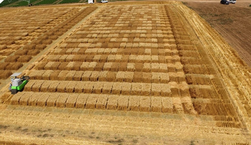
He said the inaugural flight took place in the wheat breeding plots near Dumas.
Dr. Jackie Rudd, AgriLife Research wheat breeder in Amarillo, said his interest was in quantifying traits in the wheat breeding yield trials.
“There are 2,000 plots at this site we use for the wheat variety breeding process,” Rudd said. “Each will be combined separately, weighed and analyzed for quality. This UAS flight was a trial run for us, and I couldn’t be more pleased with the results. The flight data clearly shows chaff color, lodging, shattering, height, head density and if outside sources such as animals may have damaged a plot. This is important when the combine harvests the grain and there is something to look at when the yield is lower than expected.
“Right now, it is more of a confirmation of what we already documented by walking the plots or wheat we saw coming through on the combine,” he said.
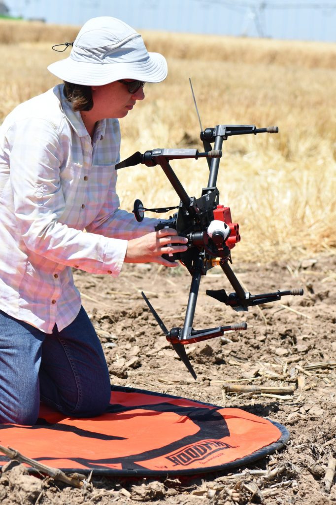
Shannon Baker, research associate with the wheat breeding program in Amarillo, piloted the drone.
Baker said it typically takes about six hours to walk all the plots and take notes, and “we do that three to four times a growing season.” With the quadcopter, she expects to be able to take weekly data in about 30 minutes per session.
“We will be able to estimate more accurately growth rate and progression of individual breeding lines and varieties,” Rudd said. “We will be able to quantify recognizable injury such as hail damage, lodging, shattering or other physical damage. And, we can look for signatures of diseases such as stripe rust or wheat streak mosaic virus, for example.”
Auvermann said on all crops more scanning by the UAS will help researchers estimate yields early in the season and make labor management decisions based on what they see.
Another benefit, he said, will be the ability to track irrigation – what the soil moisture is like and the extent to which drought stress is showing up in the health of the plants.
“Texas A&M AgriLife Research in Amarillo is moving decisively into drone-based research and we invite anyone to contact us if you they have any questions about what we are doing and why,” he said.
###
This story by Kay Ledbetter originally appeared in AgriLife Today.