Documenting Historic Black Settlements In Texas
As 1865 ushered in the end of the American Civil War, African-Americans, after centuries of enslavement, faced unfamiliar challenges with their newfound freedom. Straightaway, they assumed responsibility for living independently in environments still hostile to them.
Many of the four million freed African-Americans became sharecroppers on the plantations where they served formerly as slaves or other farms located elsewhere, and some set out for cities and towns. Approximately one million of them helped to establish self-sufficient, all-black settlements they called freedom colonies.
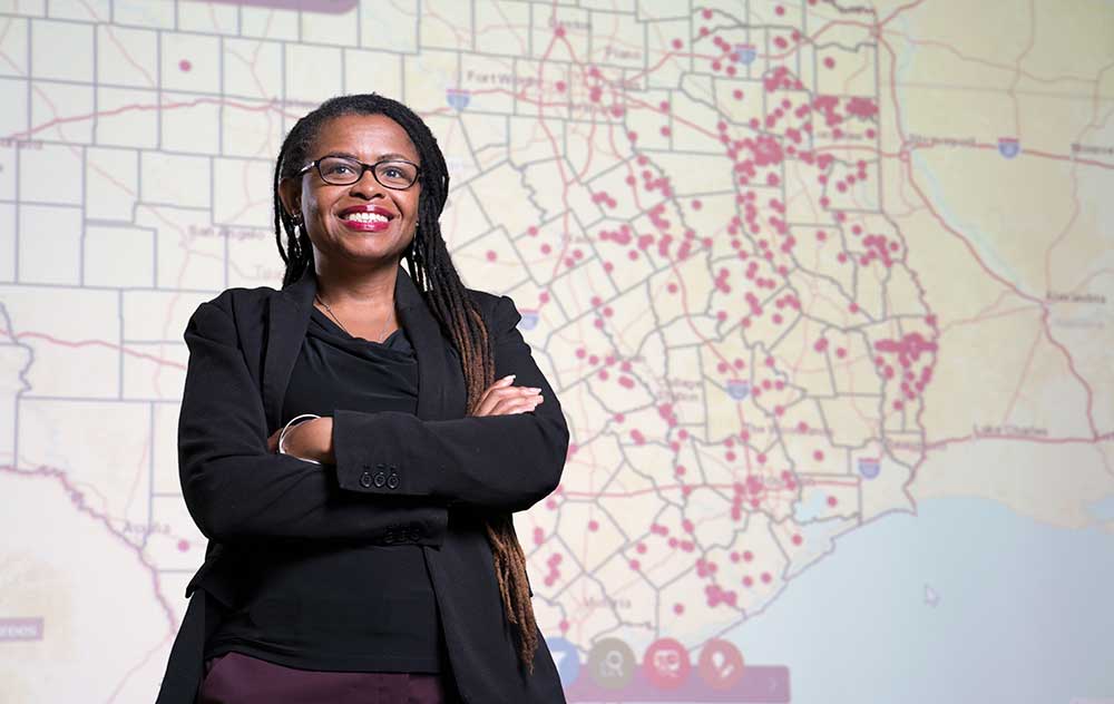
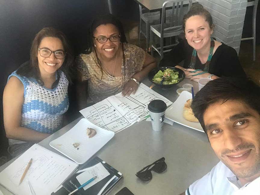
The exact number of freedom colonies existing in the United States is unknown but Andrea Roberts, assistant professor of urban planning in the College of Architecture at Texas A&M University, is helping to pioneer comprehensive documentation of those located in Texas with her Texas Freedom Colonies Project.
“Africans became hash marks on census reports when they reached America and were enslaved, leaving them, ultimately, without an understanding of their heritage or connection to their homeland,” Roberts said. “These self-sufficient freedom colonies were established under the most difficult of circumstances by industrious, intelligent and organized people acting much like current-day city planners — and some of their descendants are performing the work of preservationists today.”
A painstaking process
The mission of the project is two-fold: to help African-American Texans reclaim their unrecognized and unrecorded heritage and empower city planners to plan and preserve communities with unprecedented knowledge about the freedom colonies.
“African-Americans created intentional communities independently, and these black settlements were not substandard wards, ghettos or black neighborhoods that black people were pushed to,” Roberts said. “When making land-use decisions, I want city planners to look at these places and recognize that groups of people, even though they might live all over the place, find them very important for many different reasons.”
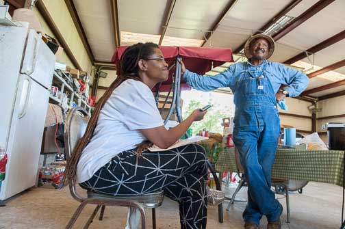
Through the painstaking process of ethnographic and archival research, Roberts has found more than 550 freedom colonies established by the almost 200,000 newly freed African-Americans living in Texas just after the abolition of slavery. Her research, which began with her dissertation at the University of Texas at Austin, is building upon earlier research conducted and published by author Thad Sitton in his book, “Freedom Colonies.”
Some of the freedom colonies currently are populated and some are not. Some descendants maintain connections, both close and distant, to these places, while opportunities exist for others to discover their ancestral roots and reconnect with old family and friends.
While certain colonies have homesteads, annual festivals, homecoming celebrations, church services and walking tours of cemeteries, others show little evidence that they ever existed. Regardless, generations of African-Americans have lived in these colonies, and many of them have handed down oral histories, including origin stories, and secured historical markers.
Roberts stresses that the project is critical in preserving a vast, complex and never-before-documented planning history that is slowly slipping away with the passing of each generation.
“History, among other things, is at stake here,” Roberts said. “We want children to know that creating freedom colonies is part of what it means to be Texan and that African-Americans are part and parcel of all of Texas.”
The Texas Freedom Colonies Project Atlas and Study, an interactive interface and digital repository developed by Roberts and her team, serves as a single, centralized location where they conduct crowdsourcing about the colonies and store their research. In the future, data collected will be vetted and shared with interested parties, including colony residents and other descendants, city planners and researchers, among others.
The team is plotting freedom colony locations on maps, identifying geographic characteristics and vulnerabilities, and recording demographics in the online portal. Once Roberts has secured more funding, her team will integrate historical and contemporary humanities information such as origin stories, genealogies, cultures, traditions, news and events, and visual and performing arts, through mediums including narrative writing, photography and videography.
Defining and reclaiming communities
Historical and current census reports do not represent all of the colonies, and, for the most part, land that was colonized just after the Civil War by African-Americans is missing from official archival records. Therefore, many of the colonies also are missing from current-day maps that are produced by the Texas Department of Transportation and the U.S. Geological Survey.
One factor that contributes significantly to this outcome is that even when reporting land ownership through proper channels at courthouses became legal for blacks, their efforts were sometimes thwarted through unofficial means such as threats and violence, Roberts said. Squatting without official ownership of their land was safer.
“You could go down to the courthouse to register your land, but a bunch of men in white hoods might show up on your land that night to run you off of your property,” Roberts said. “It happened to one of my ancestors.”
Immediately following the Civil War, everyone, regardless of race, attained land by squatting until the passing of the Homestead Act of 1866. At the same time, Texas and other Southern state legislatures passed the Black Codes, amending their homestead laws to prohibit African-Americans from taking legal possession of public land. Although the Black Codes were overturned the following year, most of the desirable property already was cherry-picked, and therefore, African-Americans settled in flood-prone bottomlands, Roberts said.
“This [project] is about changing the dynamics so that we’re focusing on accountability, and helping people define and reclaim their communities,” Roberts said. “It’s also about realizing that African-Americans built their own communities, and they should see themselves as part of urban planning, an important field where they are more commonly considered the subject.”
Putting people at the center of urban planning
Before earning her doctorate, Roberts worked in economic and community development for more than a decade, a time during which she sometimes experienced the challenges of making housing and planning decisions with inadequate information.
In the absence of official freedom colony listings in directories and designated boundaries outlined on maps, which planners use to perform their daily duties, Roberts intends for her portal to serve as a resource for this and other information not normally considered when planners make land-use decisions.
Through her methodology, she wants to substantiate freedom colonies by expanding the definition of place, and ultimately, empower planners to halt threatening land-use decisions. Characteristics that define a place, she believes, ought to include humanities data, such as history, social memory and culture, among the standard distinguishing attributes already recognized in the field of planning.
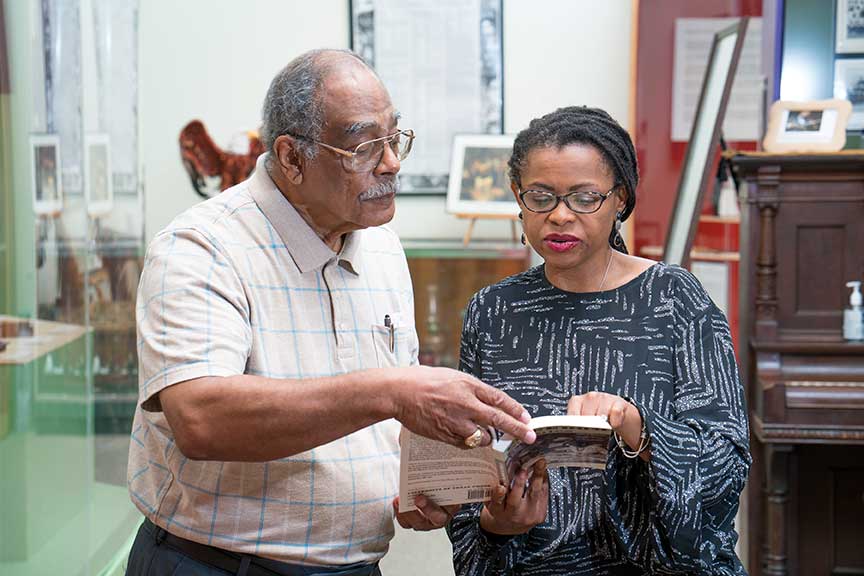
The initial focus of Roberts’s project, while still a dissertation, was on the more than 30 freedom colonies located in two East Texas counties, Newton and Jasper. Therefore, much of the information gathered to date through time-consuming ethnographic research pertains to those colonies.
For example, Shankleville, a Newton County colony of prominence during its heyday, is still home to approximately 50 families, three churches, the Odom homestead (on the National Register of Historic Places), and state historical markers. At one time, the farming community thrived with stores, a blacksmith shop, a cotton gin and a gristmill, among other enterprises.
“The founders and residents of Shankleville procured land, grew all manner of small businesses and became an epicenter of growth for satellite freedom colonies,” Roberts said.
Since the 1940s, residents of Shankleville have hosted an annual homecoming for residents and their relatives, and other known descendants of the original denizens, as well as neighbors from surrounding settlements. They gather to share memories and stories, celebrate their culture with food, worship and song, raise money for area projects and scholarships, and clean cemeteries where their ancestors are laid to rest.
Through her many conversations while conducting research for her dissertation, Roberts learned of the hundreds of other colonies located in the state, and upon her arrival at Texas A&M, she expanded the scope of her project.
Moving forward, Roberts intends to focus first on the 239 freedom colonies located in 58 counties with FEMA disaster declarations following Hurricane Harvey. Her motivation is to ensure they are receiving equitable access to resources for housing and infrastructure recovery.
“All of the colonies, whether existing or defunct, are important in both historical and contemporary contexts,” Roberts said. “My hope, my vision, is that these places will not be forgotten.”
She also hopes that researchers will use the Texas Freedom Colonies Project as a model to identify and document freedom colonies in the nation’s other states and throughout the African Diaspora.
Roberts teaches urban planning courses in the Texas A&M College of Architecture that convey core-planning skills such as ethnographic research methods, and cultural landscape identification and documentation using digital humanities tools. Her urban planning students history, heritage preservation policy and racial equity issues as they pertain to urban planning.
At the master’s level, Roberts teaches neighborhood revitalization, and planning history and theory, in the Landscape and Urban Planning Program. Next fall, she will add a new undergraduate course, “More than Monuments,” to her schedule.
As Roberts uncovers historical evidence that proves minorities have planned successful communities and mended them when necessary, she is dispelling common misconceptions that all minority communities are urban and poor, and minorities are incapable of planning their own communities.
“This throws assumptions about black and brown people upside down,” Roberts said. “We need students who are interested in stretching the field of urban planning to be more and do more, and always be focused on equity concerns and putting people at the center of planning.”
Media contact: Richard Nira at 979-845-6863 or rnira@arch.tamu.edu